![]()
![]()
|
|
Donegal,
Pennsylvania; bordered on the north and south sides by Forbes State Forest |
 |
 |
County/Counties:
Westmoreland and
The county line for |
The current owner of |
|
|
||
|
|
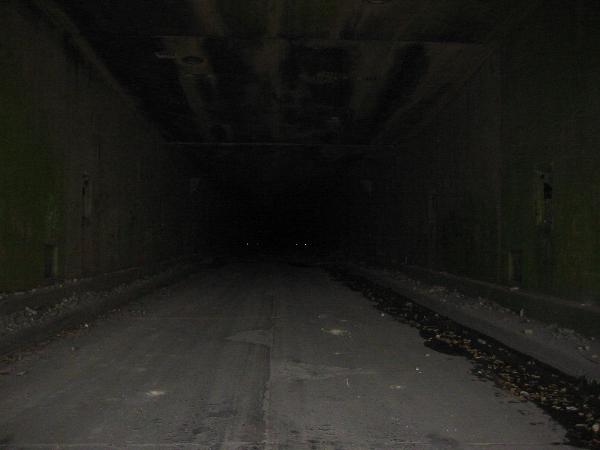 As with the photo to the left, this is the only known photo taken within the depths of Laurel Hill Tunnel. This photo was also taken in 2003, shortly before the P.T.C. began leasing the tunnel privately. |
|
|
|
|
 Beginning in 1937, the P.T.C. continued the work of the S.P.R.R. and completed the boring of Laurel Hill Tunnel.
|
Tunnel's Direction: Runs WEST-EAST,
|
LENGTHS OF THE SEVEN ORIGINAL TURNPIKE TUNNELS*: Sideling Hill Tunnel 6,782 feet Allegheny Mountain Tunnel 6,070 feet Tuscarora Mountain Tunnel 5,326 feet Kittatinny Mountain Tunnel 4,727 feet Laurel Hill Tunnel 4,541 feet Blue Mountain Tunnel 4,339 feet Ray's Hill Tunnel 3,532 feet |
4,541 feet ----------------------------------
Laurel Hill was the ---------------------------------- Only
Blue Mountain |
|
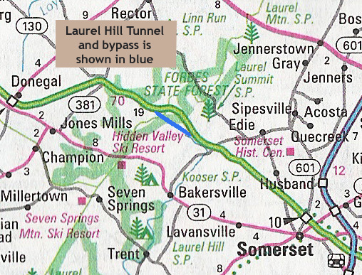
Total length of the bypass route, according to turnpike records: 3.1 miles |

|
Work began on
the |
| Total length, as
designed by the never-completed South Penn Railroad: |
5,389 feet |
|
|
|
Date Opened
|
October 1, 1940 |
|
Date
Closed to Traffic: |

The Laurel Ridge Hiking Trail traverses the Laurel Hill Tunnel, as well as the bypass route. |
This is the only foot bridge over the eastern segment of the turnpike. The direction of the trail is north-to-south. Research on the Internet has shown that multiple people have forgotten another foot bridge. There is a foot bridge near the
Allegheny River overpass on the western segment
of the turnpike
|
|
|
||
 |
Current Ownership of the Tunnel and the Right-of-Way Property: Pennsylvania Turnpike Commission |
|
|
||
 (Library of Congress) Laurel Hill Tunnel, 1940 |
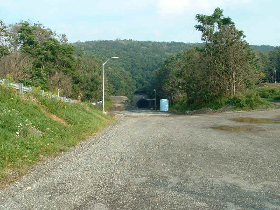
Interior Lighting: Presently, this is unconfirmed, as no one can enter the tunnel from either portal. Credible sources say that (upon their legal visitations, when the P.T.C. allowed such visits) you can faintly see light from one portal of the tunnel to the other. |
A recent visitor
to the |

|
 |
|
Laurel Hill Tunnel's Current Usage: |
Legal Visitation Permitted? NO. |
|
 |
Coordinates
of the Western Portal: (approximate) |
|
| Coordinates
of the Eastern Portal: (approximate) |
-79.21803 |
|
|
For the other
abandoned tunnel statistics pages,
please select one
|
||
![]()
This page was created
on: July 20, 2005.
Last updated on:
August 09, 2014
.
No portion of this page may be used or copied without prior permission from the .
![]()
The contents and descriptions on this page are the results of research by the webmaster of this site, as well as commentary and assistance offered by sources, some who may be quoted and some who wish to remain anonymous. All photos are used with the consent of their owners/photographers whenever possible. Some photos are in the public domain and some are taken from Internet sources who do not have contact information posted. Should you believe that the usage of any photo(s) infringes on your rights, please contact the webmaster and either grant permission for usage (notation will be made to indicate permission granted and your name/website source) or request for the picture to be withdrawn. All Library of Congress photos are in the public domain and/or used with permission of their owner.
Please report broken/dead links to: .
![]()
* PA
TURNPIKE INFORMATION SOURCE:
http://www.paturnpike.com/tools/newsletters/winter2000/page03.htm
![]()